CASE STUDY:
Biking the GAP:
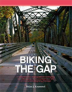
A comprehensive, visual guidebook to bicycling from Pittsburgh, PA, to Cumberland, MD, on the Great Allegheny Passage
Biking the GAP is a visual documentary of the trail, focusing on all unique and historical points of interest; the strength of this trail lies in the total sum of its parts rather than a handful of specific spectacles. The photography comprehensively represents the complex trail in all its character, charm, and personality.
The Challenge:
The Great Allegheny Passage (GAP) is a bicycle rail trail extending 150 miles between Pittsburgh, PA, and Cumberland, MD. Defunct railroad lines function as a restored corridor, connecting southwestern PA and northern MD. The vast distance and length of the trail presented the most difficult task of this project—how does someone travel 150 miles by bicycle, capture quality images, and simultaneously tell a compelling photographic story?
The Solution:
In January 2012, I started to document the trail with my camera. This was a natural fit considering my formal education in photography, love for nature, and renewed enthusiasm for cycling. Deciding on a film and camera combination, I committed to photographing the wonders along the GAP, although I didn’t fully realize the scope and immensity of such a task.
As the segment through Duquesne, PA, was completed, I made my final preparations for the ride in July. It proved to be an enjoyable month for my two-day journey between Homestead, PA, and Cumberland, MD; however, the ambitious goal of seventy miles per day proved to be very difficult. The aggressive riding schedule left little time for exploration or leisure activities, but it remains as one of the best experiences of my life. This initial ride along the entire trail also taught me another important lesson. The task of photographing the complete GAP would take much longer than I originally anticipated.
Photographic Asset Management
All the photographs were captured on traditional slide film (Fuji Velvia 50, Fuji Velvia 100, and Fuji Provia 100F) and processed in standard E-6 chemistry by a professional lab. The physical size of the transparencies are 6×4.5 cm, 6×6 cm, 6×7 cm, and 6×9 cm. I scanned the film with an Epson v500 flatbed and digitally prepared files with Adobe Photoshop on an Apple MacBook Pro.
Page Layout & Book Production
Book production continued throughout the winter of 2015. Interested in the complete process, I brought the page layout and design in-house to my own interactive media agency. This strategy helped shape and form the content into a comprehensive message while maintaining creative control of the content’s visual presentation. Page layout was completed in Adobe InDesign. The book was typeset in Palatino, Gill Sans, and Chalet. The final book is presented as an On Demand product that is printed and fulfilled by CreateSpace.
By summer of 2014, I renewed my personal commitment to finish the project. I compiled lists of all unexplored trail segments and possible points of interest. I began to visualize how this concept would someday exist in a physical paper format. By early autumn, I had a plan to photograph 50% of my undocumented segments before winter. I couldn’t lose another opportunity to photograph the beautiful fall foliage that was only a few weeks away. Many of the remaining destinations were significantly further from my home, so I incorporated a weekly cycling day into my work schedule. This decision permitted ample time to document the more distant trailheads of Confluence, Meyersdale, and beyond. Throughout 2015, the remaining gaps in my GAP documentation were completed, including the newly renovated Pinkerton Tunnel project.
Two-wheeled explorer or armchair adventurer?
Visualize a crushed limestone trail that rambles through urban neighborhoods, fertile farmlands, and panoramic mountain ranges. The weight of your body propels you through a marvelous natural world that dovetails scenic waterways. Listen to rustling leaves through a cacophony of bird songs, or breathe in the sweet aroma of blossoming wildflowers and fruit trees.
Marvel at ancient ruins from the region’s rich coal and steel heritage. Pedal across iron giants—refurbished bridges and viaducts— or travel through the cold, ghostly, darkened train tunnels. All these experiences, and many more, await you on the Great Allegheny Passage. Whether you are a two-wheeled explorer or an armchair adventurer, it’s time to decide. Are you ready for a truly amazing ride?


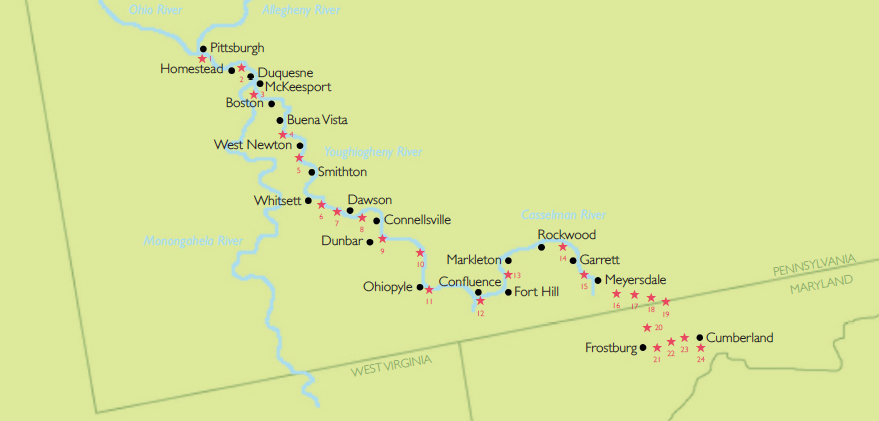
Top Twenty-four Sights along the Great Allegheny Passage
From waterfalls to abandoned ruins and natural wonders to railroad structures, the Great Allegheny Passage offers a point of interest for everyone. While this list is highly subjective, it offers a good cross-section of waypoints for the historian, the camper, the naturalist, or the adventurer in your group. Locate each of the above attractions in the book and plan your next excursion—whether a day trip or a week-long ride.
- Point State Park & Fountain
- Kennywood Park
- Dead Man’s Hollow
- Red Acid Waterfall
- Indian Post Office & Cedar Creek
- Banning Mine No. 1 & Banning Trestle
- Roundbottom Campground
- Beehive Coke Ovens
- Wheeler Bottom & Bowest Junction
- Jonathan Run Falls & Ohiopyle State Park
- Ohiopyle High Bridge & Ohiopyle Falls
- Turkeyfoot at Confluence
- Pinkerton High Bridge & Tunnel
- Wymp’s Fossil Quarry
- Salisbury Viaduct
- Keystone Viaduct & Windmill Farm
- Eastern Continental Divide
- Big Savage Tunnel
- Mason & Dixon Line Park
- Borden Tunnel
- Brush Tunnel
- Helmstetter’s Curve
- Cumberland Bone Cave & The Narrows
- Western Maryland Scenic Railroad
Excerpt:
Biking the GAP is comprised of Preface, Introduction, five regional chapters highlighting segments of the trail, Epilogue, and Index. An illustrated map highlights the trail towns along the route in addition to the top twenty-four sights along the Great Allegheny Passage. A comprehensive list of trailheads compiles the latitude, longitude, elevation, and mile marker for thirty-four entry points to access this magnificent bicycling trail. The following is an excerpt from the Introduction.
Organizationally Speaking
Beyond this introduction and overview content, Biking the GAP is organized into five geographic sections:
- Pittsburgh to West Newton
- West Newton to Connellsville
- Connellsville to Confluence
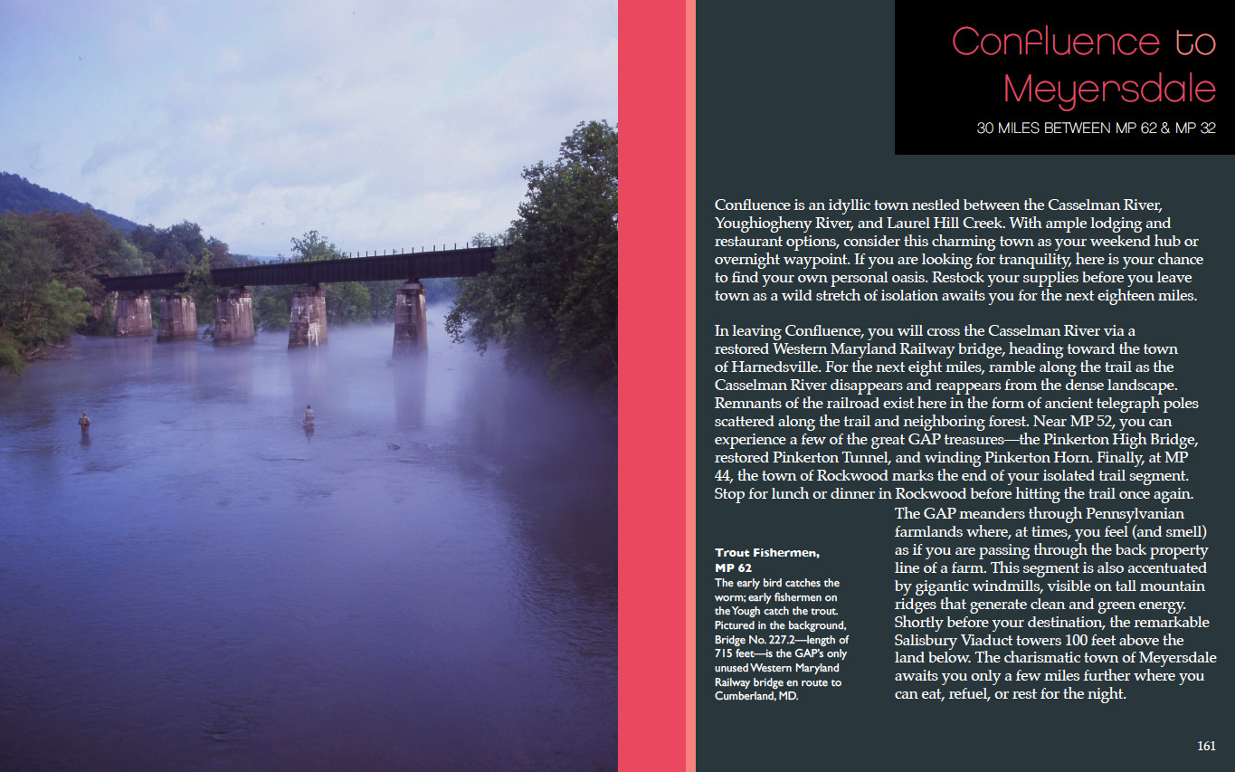
- Confluence to Meyersdale
- Meyersdale to Cumberland
Each segment represents a reasonable and leisurely day ride (for an average rider). The segments begin and end in a trail town with multiple options for parking, lodging, and dining.
The photographs are linearly arranged between each milepost from beginning to end. Each photograph is labeled with a title and the relative milepost where the reader can find that specific point of interest. Milepost 150 is the terminus at Point State Park, and subsequent markers are indicated by a decreasing milepost number.
Keep in mind that milepost indicators represented in this text are not specific to a precise tenth of a mile, but merely within the span of that mile. For instance, a point of interest titled with MP 126 will be located physically on the trail somewhere between the official milepost markers of 126 and 125. It was not the author’s intent to catalog waypoints specifically, but to allow the reader an opportunity to find them independently. Go explore for yourself! Occasionally, there are featured points of interest that are not found directly on the trail. These additional waypoints of possible interest to GAP riders may be titled with an asterisk as MP* and can be located within the context of adjacent photographs or expanded captions.
Every effort has been taken to represent the trail and points of interest in a variety of seasons, lighting conditions, and weather systems. Each segment was photographed in at least two separate seasons from multiple directions, or, in some instances, years apart. While the
photographs are in linear order, they are not always presented in the same cardinal direction. Creative liberty was taken in each instance to represent the scene in the best condition or compositional context.


